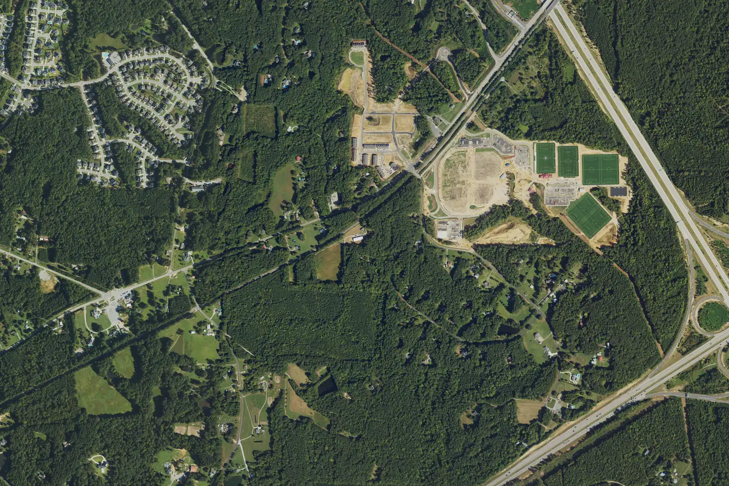
Pleasant Park and Bosco lie between the CSX railroad, NC 540 and US 1 in south Apex, mostly unincorporated, zoned for Apex Friendship High.
Last checked Oct. 11, 2026. Sources: the Town of Apex’s 2045 Land Use Map update, Western Big Branch Area Plan and Pleasant Park page, the Wake County Public School System’s base school lookup, the N.C. Department of Public Instruction’s 2025-26 accountability data, the U.S. Census Bureau’s geocoder, OpenStreetMap and Zillow Research.
Pleasant Park and Bosco are two neighboring focus areas in the town’s 2045 Land Use Map update, between the CSX railroad and US 1 in south Apex. The plan’s Pleasant Park area “encompasses future Pleasant Park and the land area between the Bosco focus area, the CSX Railroad corridor, NC 540, and US 1,” and was “mostly low density and rural residential, with several established horse farms.” Bosco, to the west, is “the area between US 1 and the CSX Railroad corridor, bounded on the west by New Hill Holleman Road.” The park is the town’s; the homes around it are mostly outside the town limits. Addresses are in ZIP code 27502 near the park and 27562 (New Hill) along Bosco Road.
What this means for you
- Zoned high school: Apex Friendship High, 87.2% of state tests at grade level in 2025-26. Check an address with the district’s base school lookup.
- Home value: $563,043 in ZIP code 27502 in August 2026, according to the Zillow Home Value Index.
- Nearest freeway exit: NC 540 Exit 57 at South Salem Street, about 1.1 miles by road from Pleasant Plains Road.
Part of our Apex neighborhoods guide.
Where it is
Pleasant Plains Road runs through the middle, past the park, and Bosco Road runs south toward US 1 farther west. The 2045 plan notes that “public comments indicate a desire to maintain current land use,” and it changes the land south of the park to rural density homes in response. It also lists two road plans: a future extension of Pleasant Plains Road across US 1 into Holly Springs, and Richardson Road, “planned to extend through” Bosco “and intersect with US 1.”
The town’s Western Big Branch Area Plan, adopted Nov. 21, 2024, covers this land too. It says “the addition of Pleasant Park has provided a new recreational facility for the residents of the study area and surrounding region” and designates a substantial portion of its study area for rural homes, at one home per acre or one per five acres.
Town or county? All six homes we checked, on Pleasant Plains Road, Silver Stirrup Lane and Bosco Road, were in unincorporated Wake County on the Census Bureau’s geocoder. Five more we checked across US 1 to the south, with Apex mailing addresses in ZIP code 27539, were inside the Town of Holly Springs. See our property tax guide.
Schools
The area is in the Wake County Public School System. All six homes we checked north of US 1 were zoned for the same three schools in the district’s base school lookup for 2026-27. The five Holly Springs addresses south of US 1 were zoned for Woods Creek Elementary, Lufkin Road Middle and Felton Grove High instead.
Scores are the share of state tests at grade level or above in 2025-26 and the state’s growth rating, from the accountability data.
| Level | School | At grade level | Growth |
|---|---|---|---|
| Elementary | Pleasant Plains Elementary, 1511 Woodall Crest Drive | 78.8% | Met |
| Middle | Apex Friendship Middle, 7701 Humie Olive Road | 89.7% | Exceeded |
| High | Apex Friendship High, 7801 Humie Olive Road | 87.2% | Exceeded |
Apex Friendship High graduated more than 95% of students in four years. More in our schools guide.
Home values
Zillow publishes no figure for this area, and its file has no series for ZIP code 27562. The Zillow Home Value Index is a modeled typical value for the middle third of homes, not a sale price.
| Area | August 2026 | August 2025 | Change |
|---|---|---|---|
| ZIP code 27502 | $563,043 | $573,522 | -1.8% |
| Town of Apex, for comparison | $592,991 | $603,410 | -1.7% |
Trends are on our home prices page.
Parks and trails
Pleasant Park, 3400 Pleasant Plains Road, is the town’s newest park: 92 acres, open 5:30 a.m. to 10 p.m. It has the 1.5-acre Enchanted Forest playground, six lighted multipurpose fields, tennis, pickleball and basketball courts, two shelters and a field house. Splashlantis, the free splash pad inside the park, is closed for the season. More in our parks and trails guide.
Getting around
- NC 540: Exit 57 at South Salem Street is about 1.1 miles by road from Pleasant Plains Road. US 1 Exit 89 at New Hill is west of Bosco.
- Downtown Apex: about 3.7 miles by road.
- RDU International Airport: about 18 miles by road.
- Buses: the town’s GoApex Route 1 ride guide names no timepoint here.
Distances were measured with the OSRM routing engine on OpenStreetMap roads. They are distances, not drive times. More in our getting around guide.
Groceries and everyday stores
OpenStreetMap lists no supermarket or pharmacy here. The nearest is the Walmart Supercenter at 3151 Apex Peakway, to the northeast.
Frequently asked questions
Where is the Pleasant Park area in Apex?
South Apex. The town’s 2045 Land Use Map update describes it as Pleasant Park and the land between the Bosco area, the CSX railroad, NC 540 and US 1. Bosco is the next area west, out to New Hill Holleman Road.
What schools serve the area around Pleasant Park?
All six addresses we checked north of US 1 were zoned for Pleasant Plains Elementary, Apex Friendship Middle and Apex Friendship High.
Is the area around Pleasant Park inside Apex town limits?
The park is a town park, but all six homes we checked nearby were in unincorporated Wake County. Across US 1 to the south, the addresses we checked were inside Holly Springs.
What is at Pleasant Park?
The town’s newest park: 92 acres at 3400 Pleasant Plains Road with the Enchanted Forest playground, six lighted fields, courts, a field house and the Splashlantis splash pad.
Have your say