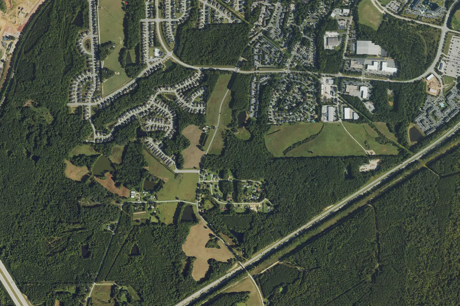
Tingen is south Apex off Tingen Road, northeast of the NC 540 and US 1 interchange, in ZIP code 27502, zoned for Apex Elementary, Middle and High.
Last checked Oct. 11, 2026. Sources: the Town of Apex’s 2045 Land Use Map update and GoApex Route 1 ride guide, the Wake County Public School System’s base school lookup, the N.C. Department of Public Instruction’s 2025-26 accountability data, the U.S. Census Bureau’s geocoder, OpenStreetMap and Zillow Research.
Tingen shares its name with Tingen Road, which runs south from downtown Apex past Apex Elementary. The town’s 2045 Land Use Map update makes it a focus area that “encompasses the northeast quadrant of the NC 540/US 1 interchange, bounded by the CSX Railroad corridor, Salem Village, existing developments south of Apex Peakway, and the properties south of US 1 sited for a future interchange with the extension of Perry Road.” In 2019 the plan called it “mostly vacant or agricultural land” and said that when the Veridea development south of US 1 moves forward, “there will be a drastic change to this area.” Most of it is in ZIP code 27502; Veridea Parkway is in 27539.
What this means for you
- Zoned high school: Apex High north of US 1, 74.3% of state tests at grade level in 2025-26. Check an address with the district’s base school lookup.
- Home value: $563,043 in ZIP code 27502 in August 2026, according to the Zillow Home Value Index.
- Nearest freeway exit: US 1 Exit 95 at NC 55, about 1.4 miles by road from Salem Village.
Part of our Apex neighborhoods guide.
Where it is
The area runs from the subdivisions south of the Apex Peakway down to US 1, with NC 540 on the west. The plan says Salem Village “extends along the northern boundary and includes stub streets that can be extended for future development.” It notes that “long range plans include future commuter rail service to this area” and extends planned medium and high density homes and offices along Tingen Road to the Apex Peakway. South of US 1, Veridea Parkway now meets NC 540 at Exit 55.
Town or county? The five addresses we checked north of US 1, on Padstone Drive, Irongate Drive, Salem Village Drive, Shackleton Road and Dual Parks Road, were inside the Town of Apex on the Census Bureau’s geocoder. One on Veridea Parkway was in unincorporated Wake County. See our property tax guide.
Schools
The area is in the Wake County Public School System, and US 1 divides its zones. In the district’s base school lookup for 2026-27, all five addresses north of US 1 were zoned for Apex Elementary, Apex Middle and Apex High. The one on Veridea Parkway was zoned for Woods Creek Elementary, Lufkin Road Middle and Felton Grove High.
Scores are the share of state tests at grade level or above in 2025-26 and the state’s growth rating, from the accountability data.
| Level | School | At grade level | Growth |
|---|---|---|---|
| Elementary | Apex Elementary, 700 Tingen Road | 71.7% | Not met |
| Elementary | Woods Creek Elementary, 7451 Woods Creek Road, Holly Springs | 79.6% | Met |
| Middle | Apex Middle, 400 E. Moore St. | 70.5% | Met |
| Middle | Lufkin Road Middle, 1002 Lufkin Road | 67.0% | Not met |
| High | Apex High, 1501 Laura Duncan Road | 74.3% | Met |
| High | Felton Grove High, 5100 Thriftwood Drive | 81.2% | Exceeded |
Apex High graduated more than 95% of students in four years. Felton Grove High has no graduation rate yet; its scores are in the state’s accountability data. More in our schools guide.
Home values
Zillow publishes no figure for Tingen. The Zillow Home Value Index is a modeled typical value for the middle third of homes, not a sale price.
| Area | August 2026 | August 2025 | Change |
|---|---|---|---|
| ZIP code 27502 | $563,043 | $573,522 | -1.8% |
| ZIP code 27539 (Veridea Parkway) | $602,760 | $606,331 | -0.6% |
| Town of Apex, for comparison | $592,991 | $603,410 | -1.7% |
Trends are on our home prices page.
Parks and trails
The town lists no park inside the area on its parks pages. The nearest are Sue Helton Park, a quarter-acre park with a gazebo and playground at 703 Matney Lane, north of the Peakway, and Pleasant Park, 3400 Pleasant Plains Road, west across NC 540. More in our parks and trails guide.
Getting around
- US 1: Exit 95 at NC 55 is about 1.4 miles by road from Salem Village.
- NC 540: Exit 55 at Veridea Parkway is about 2.2 miles by road.
- Downtown Apex: about 1.6 miles by road.
- RDU International Airport: about 18 miles by road.
- Buses: the free GoApex Route 1 has a timepoint on Tingen Road at Peace Haven Place, every 30 minutes from 6 a.m. to 7 p.m. Monday to Saturday.
Distances were measured with the OSRM routing engine on OpenStreetMap roads from Salem Village Drive. They are distances, not drive times. More in our getting around guide.
Groceries and everyday stores
OpenStreetMap lists a Walmart Supercenter at 3151 Apex Peakway, on the area’s east side. The GoApex Route 1 ride guide also names a Walmart stop.
Frequently asked questions
Where is the Tingen area in Apex?
South Apex, in what the town’s 2045 Land Use Map update calls the northeast quadrant of the NC 540 and US 1 interchange, between the CSX railroad, Salem Village and the developments south of the Apex Peakway.
What schools serve the Tingen area?
The five addresses we checked north of US 1 were zoned for Apex Elementary, Apex Middle and Apex High. One on Veridea Parkway, south of US 1, was zoned for Woods Creek Elementary, Lufkin Road Middle and Felton Grove High.
Is there a bus on Tingen Road?
Yes. The free GoApex Route 1 has a timepoint on Tingen Road at Peace Haven Place, according to the town’s ride guide.
What is the typical home value near Tingen Road?
The Zillow Home Value Index for ZIP code 27502 was $563,043 in August 2026. Veridea Parkway, south of US 1, is in ZIP code 27539, at $602,760.
Have your say